Aqueduc de Nîmes à Remoulins
Chargement de la carte...
Précision de la localisation : 6 - A priori satisfaisante >> Votre avis :

Crédit photo : Clem Rutter, Rochester Kent - Sous licence Creative Commons
Street View Modifier la localisation
![]() Monument Historique
Monument Historique
Adresse renseignée dans la base Mérimée :
30210 Remoulins - France
Code Insee de la commune : 30212
Gard [30] - Nîmes - Languedoc Roussillon (Occitanie)
Adresse approximative issue des coordonnées GPS (latitude et longitude) :
5116 Rue du Château 30210 Pouzilhac
Eléments protégés :
Les vestiges archéologiques de l'aqueduc de Nîmes et les parcelles traversées ou bordées par son tracé (cad. AB 29, 34, 46, 47, 68, 77, 86, 92) : inscription par arrêté du 13 janvier 1998
Historique :
Tronçons de l'aqueduc antique de Nîmes. Vestiges apparents ou enfouis. Pour ce qui est du canal du Pouzin, il semble difficile de séparer les deux tracés ; la question de l'adduction d'eau à Nîmes au XIXe siècle n'est pas sans intérêt. Ce deuxième canal double une partie de l'aqueduc : au XIXe siècle de multiples projets ont conduit à cet aménagement abandonné ; d'un diamètre supérieur (2, 20 à 3m) , cette conduite reprend le tracé antique jusqu'à lui être parfois superposée et il est alors très difficile de les distinguer l'une de l'autre ; Même si le gabarit plus important impose à certains endroits un rayon de courbure plus grand et donc un écart de 1 à 2m, le tracé récent reste proche et sur la même parcelle que celui de l'époque romaine. Le relief du terrain a varié entre l'antiquité et maintenant, des dépôts d'alluvions modifiant les courbes de niveaux et dissimulant des éperons rocheux responsables d'une légère déviation de l'ouvrage qui les contourne ; ceci à quelques mètres près seulement. C'est pourquoi la protection porte bien sur la totalité des parcelles et non pas sur une simple ligne. Chaque parcelle présente en fait une situation différente. Les vestiges archéologiques dégagés et fouillés sont de deux sortes : 1/ ceux qui présentent uniquement un intérêt scientifique peuvent dans certains cas être réenfouis, une grande partie étant déjà souterraine ; 2/ les parties visibles et notamment les ouvrages d'art comme les ponts peuvent mériter d'être présentés au public et devront être mis à l'abri des dégradations, y compris naturelles .
Périodes de construction :
Gallo-romain, XIXe siècle
Propriété de la commune ; propriété privée
Informations pratiques de visite ou services :
Ouvert ou fermé à la visite, location de salle, chambres d'hôtes ?
Autres photographies :

Aqueduc de Nîmes à Remoulins
Français : Noria aqueduc romain

Aqueduc de Nîmes à Remoulins
Français : Aqueduct of Nîmes

Aqueduc de Nîmes à Remoulins
Français : Carte géographique de l'aqueduc du Pont du Gard, France. Carte créée à partir des données d’OpenStreetMap.

Aqueduc de Nîmes à Remoulins
Français : le Pont de la Combe Pradier fait parti de l'aqueduc de Nîmes, vestige romain dont le tronçon le plus connu est le Pont du Gard


Aqueduc de Nîmes à Remoulins
English: Cross section of the Pont du Gard by Alfred Léger (1875)

Aqueduc de Nîmes à Remoulins
Français : Dessin du Pont du Gard

Aqueduc de Nîmes à Remoulins
English: Identifier: historyofromeromv4p1duru (find matches) Title: History of Rome and the Roman people, from its origin to the establishment of the Christian empire Year: 1884 (1880s) Authors: Duruy, Victor, 1811-1894 Subjects: Publisher: London, Paul Contributing Library: Robarts - University of Toronto Digitizing Sponsor: University of Toronto View Book Page: Book Viewer About This Book: Catalog Entry View All Images: All Images From Book Click here to view book online to see this illustration in context in a browseable online version of this book. Text Appearing Before Image: es. Her greatest wealth,however, lay in her mines of gold, silver, iron, and copper.1 In 1 Cic., de Re publ., iii. 9. 2 Strabo describes curiously the evolutions of the army of tunny-fish all along the coast,where, about the time of their annual arrival, sentinels were posted to give notice of theirapproach. 1 Aulus Gellius, Noct. Attica, ii. 22. 1 ))iod., v. 36; Pliny, Hist. Nat., xxxviii. 2. There were iron mines and really excellentiron-works at Cape Dianium, called, on this account, by Pomponius Mela, Ferraria ; and wateruseful for tempering near Bdbilis and Turiasso. Horace mentions Spanish cuirasses, loricisTberis ( Carm., 1. xxix. 15). In the gold mines of Baetica, nuggets of ten Koman pounds weighthad been found. (Pliny, ibid., xxxiii. 4.) In Turdetania, a fourth part of the ore taken out oftlie mine was pure copper. (Strabo, iii. 7.) There was tin in the country of the Gallajci. andlead at Caatalon, where it is found to this daw The Tagus and other rivers of Lusitania lIMfi 1 Text Appearing After Image: £ « o (, 2 THE ADMINISTRATION OF AUGUSTUS IN THE PROVINCES. 85 the north of Spain, the Cerretans and Cantabrians exported excellenthams, which furnished this people a very advantageous traffic.The horses of Asturia and Cantabria, small, but very active, wereso famous after the Areneti had abandoned horse-breeding that theKomans called all their best animals Asturiones, and Posidoniuscompares the horses of the Celtiberians to those of the Parthianson account of their extreme speed. In the north-east of Italy, Ehaetic wine was considered asgood as the best wines of the peninsula, and the mountaineersof the Alps bartered their honey, wax, resin, and cheese for theItalian commodities of which they had need. Across Mont Ocra,the lowest part of the Eastern Alps, the merchandise of Aquileiawas transported in wagons to Nauportus upon the Leybach, abranch of the Save, where it was embarked and carried downto the Danube, and thence to Segestum, or into Pannonia orNoricum. Aquileia, which poss Note About Images Please note that these images are extracted from scanned page images that may have been digitally enhanced for readability - coloration and appearance of these illustrations may not perfectly resemble the original work.


Aqueduc de Nîmes à Remoulins
Français : Gravure du Pont du Gard par C.L.-Clérisseau

Aqueduc de Nîmes à Remoulins
Français : Gravure du Pont du Gard par C.L.-Clérisseau


Aqueduc de Nîmes à Remoulins
English: Identifier: materialsdocumen02unse (find matches) Title: Materials and documents of architecture and sculpture : classified alphabetically Year: 1915 (1910s) Authors: Subjects: Decoration and ornament, Architectural Publisher: Chicago : G. Broes Van Dort Co. Contributing Library: Getty Research Institute Digitizing Sponsor: Getty Research Institute View Book Page: Book Viewer About This Book: Catalog Entry View All Images: All Images From Book Click here to view book online to see this illustration in context in a browseable online version of this book. Text Appearing Before Image: A. Raguenet Architectef okdateur PUBLICATION MENSUELLE 412me Numéro R.DUCHER Editeur3 Rue des Poitevins.PARIS Text Appearing After Image: ' Note About Images Please note that these images are extracted from scanned page images that may have been digitally enhanced for readability - coloration and appearance of these illustrations may not perfectly resemble the original work.

Aqueduc de Nîmes à Remoulins
Français : Pont du Gard

Aqueduc de Nîmes à Remoulins
English: View of the aqueduct with its three tiers of arches. c.1820-4 Lithograph on chine collé

Aqueduc de Nîmes à Remoulins
Français : Maquette du pont du Gard à France Miniature (Élancourt)

Aqueduc de Nîmes à Remoulins


Aqueduc de Nîmes à Remoulins
The Pont du Gard, a Roman aqueduct/bridge, France. Process print. Iconographic Collections

Aqueduc de Nîmes à Remoulins
English: Derived from File:Pont Du Gare

Aqueduc de Nîmes à Remoulins
Deutsch: Pont du Gard bei Nismes


Aqueduc de Nîmes à Remoulins

Aqueduc de Nîmes à Remoulins

Aqueduc de Nîmes à Remoulins

Aqueduc de Nîmes à Remoulins

Aqueduc de Nîmes à Remoulins

Aqueduc de Nîmes à Remoulins
French geographer and opinion journalist

Aqueduc de Nîmes à Remoulins

Aqueduc de Nîmes à Remoulins

Aqueduc de Nîmes à Remoulins
French photographer


Aqueduc de Nîmes à Remoulins
French painter and lithographer

Aqueduc de Nîmes à Remoulins
French painter and drawer

Aqueduc de Nîmes à Remoulins
German painter


![Aqueduc de Nîmes - Français : Sujet : Sport automobile
Autocars Raid Saurer des 100 000 kms Collectionneur : Lamberjack, Dominique (1878-1948). Collectionneur Appartient à l’ensemble documentaire : MnS000 Langue : sans contenu linguistique Éditeur : [s.n.]](https://p.monumentum.fr/galerie/maxi/01052/1052298-francais-sujet-sport-automobile-autocars-raid-saurer-des-100-000-kms-collectionneur-lamberjack-dominique-1878-1948-collectionneur-appartient-a-lensemble-documentaire-mns000-langue-sans-contenu-linguis.jpg)
Aqueduc de Nîmes à Remoulins
Français : Sujet : Sport automobile Autocars Raid Saurer des 100 000 kms Collectionneur : Lamberjack, Dominique (1878-1948). Collectionneur Appartient à l’ensemble documentaire : MnS000 Langue : sans contenu linguistique Éditeur : [s.n.]
![Aqueduc de Nîmes - Polski: Adres wydawniczy: Paris : L. Hachette, 1874Współtwórcy: Ferrand, Jules (1817-1894) AutorOpis fizyczny: VIII, 445, 102 s., [5] k. tabl. : il. ; 20 cm](https://p.monumentum.fr/galerie/maxi/01063/1063747-polski-adres-wydawniczy-paris-l-hachette-1874wspoltworcy-ferrand-jules-1817-1894-autoropis-fizyczny-viii-445-102-s-5-k-tabl-il-20-cm.jpg)
Aqueduc de Nîmes à Remoulins
Polski: Adres wydawniczy: Paris : L. Hachette, 1874Współtwórcy: Ferrand, Jules (1817-1894) AutorOpis fizyczny: VIII, 445, 102 s., [5] k. tabl. : il. ; 20 cm

Fiche Mérimée : PA30000021
Dernière mise à jour de la fiche Monumentum : 2026-06-07
Consultez le programme des Journées du Patrimoine pour le Monument Historique Aqueduc de Nîmes situé à Remoulins en consultant le programme officiel des JEP 2026.
A proximité :
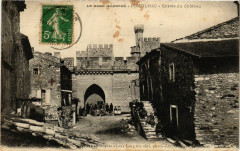
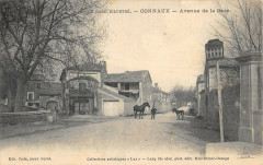
Cartes postales anciennes à proximité :