Menhirs constituant le premier groupe dit de la Fage aux Bondons
Chargement de la carte...
Précision de la localisation : 6 - A priori satisfaisante >> Votre avis :
Street View Modifier la localisation
![]() Monument Historique
Monument Historique
Adresse renseignée dans la base Mérimée :
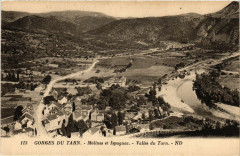
48400 Les Bondons - France
Code Insee de la commune : 48028
Lozère [48] - Mende - Languedoc Roussillon (Occitanie)
Adresse approximative issue des coordonnées GPS (latitude et longitude) :
Eléments protégés :
Quatorze menhirs constituant le premier groupe dit de la Fage, sur le Causse de la Fage : inscription par arrêté du 5 juin 1941
Périodes de construction :
Néolithique
Propriété privée
Informations pratiques de visite ou services :
Ouvert ou fermé à la visite, location de salle, chambres d'hôtes ?
Autres photographies :

Menhirs constituant le premier groupe dit de la Fage aux Bondons
English: The « Pierre des trois paroisses » (=‘Three Parishes Stone’), one of the standing stones in the ‘Cham des Bondons’ site, Lozère, France.

Menhirs constituant le premier groupe dit de la Fage aux Bondons
Čeština: Menhirs de la Fage This building is indexed in the base Mérimée, a database of architectural heritage maintained by the French Ministry of Culture, under the reference PA00103796. العربية ∙ беларуская (тарашкевіца) ∙ বাংলা ∙ brezhoneg ∙ català ∙ Deutsch ∙ Ελληνικά ∙ English ∙ Esperanto ∙ español ∙ euskara ∙ suomi ∙ français ∙ magyar ∙ italiano ∙ 日本語 ∙ македонски ∙ Nederlands ∙ português ∙ português do Brasil ∙ română ∙ русский ∙ sicilianu ∙ slovenščina ∙ svenska ∙ українська ∙ +/− Camera location44° 24′ 58″ N, 3° 34′ 59.77″ E View this and other nearby images on: OpenStreetMap 44.416111; 3.583269

Menhirs constituant le premier groupe dit de la Fage aux Bondons
Čeština: Menhirs de la Fage This building is indexed in the base Mérimée, a database of architectural heritage maintained by the French Ministry of Culture, under the reference PA00103796. العربية ∙ беларуская (тарашкевіца) ∙ বাংলা ∙ brezhoneg ∙ català ∙ Deutsch ∙ Ελληνικά ∙ English ∙ Esperanto ∙ español ∙ euskara ∙ suomi ∙ français ∙ magyar ∙ italiano ∙ 日本語 ∙ македонски ∙ Nederlands ∙ português ∙ português do Brasil ∙ română ∙ русский ∙ sicilianu ∙ slovenščina ∙ svenska ∙ українська ∙ +/− Camera location44° 24′ 36.98″ N, 3° 34′ 36.44″ E View this and other nearby images on: OpenStreetMap 44.410272; 3.576789

Menhirs constituant le premier groupe dit de la Fage aux Bondons
English: Menhirs de la Fage This building is indexed in the base Mérimée, a database of architectural heritage maintained by the French Ministry of Culture, under the reference PA00103796. العربية ∙ беларуская (тарашкевіца) ∙ বাংলা ∙ brezhoneg ∙ català ∙ Deutsch ∙ Ελληνικά ∙ English ∙ Esperanto ∙ español ∙ euskara ∙ suomi ∙ français ∙ magyar ∙ italiano ∙ 日本語 ∙ македонски ∙ Nederlands ∙ português ∙ português do Brasil ∙ română ∙ русский ∙ sicilianu ∙ slovenščina ∙ svenska ∙ українська ∙ +/− Camera location44° 25′ 08.54″ N, 3° 35′ 09.62″ E View this and other nearby images on: OpenStreetMap 44.419039; 3.586006

Menhirs constituant le premier groupe dit de la Fage aux Bondons
Čeština: Menhirs de la Fage This building is indexed in the base Mérimée, a database of architectural heritage maintained by the French Ministry of Culture, under the reference PA00103796. العربية ∙ беларуская (тарашкевіца) ∙ বাংলা ∙ brezhoneg ∙ català ∙ Deutsch ∙ Ελληνικά ∙ English ∙ Esperanto ∙ español ∙ euskara ∙ suomi ∙ français ∙ magyar ∙ italiano ∙ 日本語 ∙ македонски ∙ Nederlands ∙ português ∙ português do Brasil ∙ română ∙ русский ∙ sicilianu ∙ slovenščina ∙ svenska ∙ українська ∙ +/− Camera location44° 24′ 36.98″ N, 3° 34′ 36.44″ E View this and other nearby images on: OpenStreetMap 44.410272; 3.576789

Menhirs constituant le premier groupe dit de la Fage aux Bondons
Čeština: Menhirs de la Fage

Menhirs constituant le premier groupe dit de la Fage aux Bondons
Čeština: Menhirs de la Fage This building is indexed in the base Mérimée, a database of architectural heritage maintained by the French Ministry of Culture, under the reference PA00103796. العربية ∙ беларуская (тарашкевіца) ∙ বাংলা ∙ brezhoneg ∙ català ∙ Deutsch ∙ Ελληνικά ∙ English ∙ Esperanto ∙ español ∙ euskara ∙ suomi ∙ français ∙ magyar ∙ italiano ∙ 日本語 ∙ македонски ∙ Nederlands ∙ português ∙ português do Brasil ∙ română ∙ русский ∙ sicilianu ∙ slovenščina ∙ svenska ∙ українська ∙ +/− Camera location44° 24′ 36.98″ N, 3° 34′ 36.44″ E View this and other nearby images on: OpenStreetMap 44.410272; 3.576789

Menhirs constituant le premier groupe dit de la Fage aux Bondons
Čeština: Menhirs de la Fage This building is indexed in the base Mérimée, a database of architectural heritage maintained by the French Ministry of Culture, under the reference PA00103796. العربية ∙ беларуская (тарашкевіца) ∙ বাংলা ∙ brezhoneg ∙ català ∙ Deutsch ∙ Ελληνικά ∙ English ∙ Esperanto ∙ español ∙ euskara ∙ suomi ∙ français ∙ magyar ∙ italiano ∙ 日本語 ∙ македонски ∙ Nederlands ∙ português ∙ português do Brasil ∙ română ∙ русский ∙ sicilianu ∙ slovenščina ∙ svenska ∙ українська ∙ +/− Camera location44° 24′ 55.65″ N, 3° 34′ 58.11″ E View this and other nearby images on: OpenStreetMap 44.415458; 3.582808

Menhirs constituant le premier groupe dit de la Fage aux Bondons
Čeština: Menhirs de la Fage This building is indexed in the base Mérimée, a database of architectural heritage maintained by the French Ministry of Culture, under the reference PA00103796. العربية ∙ беларуская (тарашкевіца) ∙ বাংলা ∙ brezhoneg ∙ català ∙ Deutsch ∙ Ελληνικά ∙ English ∙ Esperanto ∙ español ∙ euskara ∙ suomi ∙ français ∙ magyar ∙ italiano ∙ 日本語 ∙ македонски ∙ Nederlands ∙ português ∙ português do Brasil ∙ română ∙ русский ∙ sicilianu ∙ slovenščina ∙ svenska ∙ українська ∙ +/− Camera location44° 24′ 42.16″ N, 3° 34′ 46.25″ E View this and other nearby images on: OpenStreetMap 44.411711; 3.579514

Menhirs constituant le premier groupe dit de la Fage aux Bondons
Čeština: Menhirs de la Fage This building is indexed in the base Mérimée, a database of architectural heritage maintained by the French Ministry of Culture, under the reference PA00103796. العربية ∙ беларуская (тарашкевіца) ∙ বাংলা ∙ brezhoneg ∙ català ∙ Deutsch ∙ Ελληνικά ∙ English ∙ Esperanto ∙ español ∙ euskara ∙ suomi ∙ français ∙ magyar ∙ italiano ∙ 日本語 ∙ македонски ∙ Nederlands ∙ português ∙ português do Brasil ∙ română ∙ русский ∙ sicilianu ∙ slovenščina ∙ svenska ∙ українська ∙ +/− Camera location44° 24′ 48.98″ N, 3° 34′ 52.86″ E View this and other nearby images on: OpenStreetMap 44.413606; 3.581350

Menhirs constituant le premier groupe dit de la Fage aux Bondons
English: One of the standing stones in the ‘Cham des Bondons’ site, Lozère, France.

Menhirs constituant le premier groupe dit de la Fage aux Bondons
English: “Cham des Bondons” site, Lozère, France: the stone row with the three menhirs of Chabusse, part of the second group so-called La Fage.

Menhirs constituant le premier groupe dit de la Fage aux Bondons
Čeština: Menhirs de la Fage This building is indexed in the base Mérimée, a database of architectural heritage maintained by the French Ministry of Culture, under the reference PA00103797. العربية ∙ беларуская (тарашкевіца) ∙ বাংলা ∙ brezhoneg ∙ català ∙ Deutsch ∙ Ελληνικά ∙ English ∙ Esperanto ∙ español ∙ euskara ∙ suomi ∙ français ∙ magyar ∙ italiano ∙ 日本語 ∙ македонски ∙ Nederlands ∙ português ∙ português do Brasil ∙ română ∙ русский ∙ sicilianu ∙ slovenščina ∙ svenska ∙ українська ∙ +/− Camera location44° 24′ 18.54″ N, 3° 34′ 54.48″ E View this and other nearby images on: OpenStreetMap 44.405150; 3.581800

Menhirs constituant le premier groupe dit de la Fage aux Bondons
Čeština: Menhirs de la Fage This building is indexed in the base Mérimée, a database of architectural heritage maintained by the French Ministry of Culture, under the reference PA00103797. العربية ∙ беларуская (тарашкевіца) ∙ বাংলা ∙ brezhoneg ∙ català ∙ Deutsch ∙ Ελληνικά ∙ English ∙ Esperanto ∙ español ∙ euskara ∙ suomi ∙ français ∙ magyar ∙ italiano ∙ 日本語 ∙ македонски ∙ Nederlands ∙ português ∙ português do Brasil ∙ română ∙ русский ∙ sicilianu ∙ slovenščina ∙ svenska ∙ українська ∙ +/− Camera location44° 24′ 20.37″ N, 3° 34′ 56.14″ E View this and other nearby images on: OpenStreetMap 44.405658; 3.582261

Menhirs constituant le premier groupe dit de la Fage aux Bondons
Čeština: Menhirs de la Fage This building is indexed in the base Mérimée, a database of architectural heritage maintained by the French Ministry of Culture, under the reference PA00103797. العربية ∙ беларуская (тарашкевіца) ∙ বাংলা ∙ brezhoneg ∙ català ∙ Deutsch ∙ Ελληνικά ∙ English ∙ Esperanto ∙ español ∙ euskara ∙ suomi ∙ français ∙ magyar ∙ italiano ∙ 日本語 ∙ македонски ∙ Nederlands ∙ português ∙ português do Brasil ∙ română ∙ русский ∙ sicilianu ∙ slovenščina ∙ svenska ∙ українська ∙ +/− Camera location44° 24′ 21.44″ N, 3° 34′ 57.11″ E View this and other nearby images on: OpenStreetMap 44.405956; 3.582531

Menhirs constituant le premier groupe dit de la Fage aux Bondons
Čeština: Menhirs de la Fage This building is indexed in the base Mérimée, a database of architectural heritage maintained by the French Ministry of Culture, under the reference PA00103797. العربية ∙ беларуская (тарашкевіца) ∙ বাংলা ∙ brezhoneg ∙ català ∙ Deutsch ∙ Ελληνικά ∙ English ∙ Esperanto ∙ español ∙ euskara ∙ suomi ∙ français ∙ magyar ∙ italiano ∙ 日本語 ∙ македонски ∙ Nederlands ∙ português ∙ português do Brasil ∙ română ∙ русский ∙ sicilianu ∙ slovenščina ∙ svenska ∙ українська ∙ +/− Camera location44° 24′ 30.69″ N, 3° 35′ 06.55″ E View this and other nearby images on: OpenStreetMap 44.408525; 3.585153

Menhirs constituant le premier groupe dit de la Fage aux Bondons
Čeština: Menhirs de la Fage This building is indexed in the base Mérimée, a database of architectural heritage maintained by the French Ministry of Culture, under the reference PA00103797. العربية ∙ беларуская (тарашкевіца) ∙ বাংলা ∙ brezhoneg ∙ català ∙ Deutsch ∙ Ελληνικά ∙ English ∙ Esperanto ∙ español ∙ euskara ∙ suomi ∙ français ∙ magyar ∙ italiano ∙ 日本語 ∙ македонски ∙ Nederlands ∙ português ∙ português do Brasil ∙ română ∙ русский ∙ sicilianu ∙ slovenščina ∙ svenska ∙ українська ∙ +/− Camera location44° 24′ 33.47″ N, 3° 35′ 14.22″ E View this and other nearby images on: OpenStreetMap 44.409297; 3.587283

Menhirs constituant le premier groupe dit de la Fage aux Bondons
Čeština: Menhirs de la Fage This building is indexed in the base Mérimée, a database of architectural heritage maintained by the French Ministry of Culture, under the reference PA00103797. العربية ∙ беларуская (тарашкевіца) ∙ বাংলা ∙ brezhoneg ∙ català ∙ Deutsch ∙ Ελληνικά ∙ English ∙ Esperanto ∙ español ∙ euskara ∙ suomi ∙ français ∙ magyar ∙ italiano ∙ 日本語 ∙ македонски ∙ Nederlands ∙ português ∙ português do Brasil ∙ română ∙ русский ∙ sicilianu ∙ slovenščina ∙ svenska ∙ українська ∙ +/− Camera location44° 24′ 51.79″ N, 3° 35′ 33.84″ E View this and other nearby images on: OpenStreetMap 44.414386; 3.592733

Menhirs constituant le premier groupe dit de la Fage aux Bondons
Čeština: Menhirs de la Fage This building is indexed in the base Mérimée, a database of architectural heritage maintained by the French Ministry of Culture, under the reference PA00103797. العربية ∙ беларуская (тарашкевіца) ∙ বাংলা ∙ brezhoneg ∙ català ∙ Deutsch ∙ Ελληνικά ∙ English ∙ Esperanto ∙ español ∙ euskara ∙ suomi ∙ français ∙ magyar ∙ italiano ∙ 日本語 ∙ македонски ∙ Nederlands ∙ português ∙ português do Brasil ∙ română ∙ русский ∙ sicilianu ∙ slovenščina ∙ svenska ∙ українська ∙ +/− Camera location44° 24′ 53.83″ N, 3° 35′ 36.6″ E View this and other nearby images on: OpenStreetMap 44.414953; 3.593500

Menhirs constituant le premier groupe dit de la Fage aux Bondons
Čeština: Menhirs de la Fage This building is indexed in the base Mérimée, a database of architectural heritage maintained by the French Ministry of Culture, under the reference PA00103797. العربية ∙ беларуская (тарашкевіца) ∙ বাংলা ∙ brezhoneg ∙ català ∙ Deutsch ∙ Ελληνικά ∙ English ∙ Esperanto ∙ español ∙ euskara ∙ suomi ∙ français ∙ magyar ∙ italiano ∙ 日本語 ∙ македонски ∙ Nederlands ∙ português ∙ português do Brasil ∙ română ∙ русский ∙ sicilianu ∙ slovenščina ∙ svenska ∙ українська ∙ +/− Camera location44° 24′ 54.03″ N, 3° 35′ 42.55″ E View this and other nearby images on: OpenStreetMap 44.415008; 3.595153

Menhirs constituant le premier groupe dit de la Fage aux Bondons

Menhirs constituant le premier groupe dit de la Fage aux Bondons

Menhirs constituant le premier groupe dit de la Fage aux Bondons

Menhirs constituant le premier groupe dit de la Fage aux Bondons

Menhirs constituant le premier groupe dit de la Fage aux Bondons

Menhirs constituant le premier groupe dit de la Fage aux Bondons

Menhirs constituant le premier groupe dit de la Fage aux Bondons

Menhirs constituant le premier groupe dit de la Fage aux Bondons

Menhirs constituant le premier groupe dit de la Fage aux Bondons
Fiche Mérimée : PA00103796
Dernière mise à jour de la fiche Monumentum : 2026-06-28
Consultez le programme des Journées du Patrimoine pour le Monument Historique Menhirs constituant le premier groupe dit de la Fage situé aux Bondons en consultant le programme officiel des JEP 2026.
A proximité :
Cartes postales anciennes à proximité :